Your cart is currently empty!
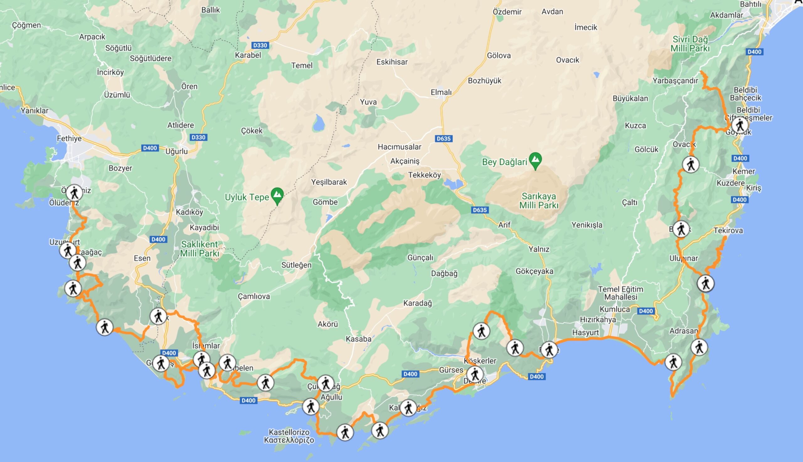
Hiking From Patara to Akbel on the Lycian Way
Total Distance: 33km
Patara to Akbel is considered the most boring section of the Lycian Way.
That’s why I’ve combined these 33km into a single section.
Most people will take a minibus from Patara to Akbel to skip this section and join the trail at Akbel.
If you want to hike this section, here are the details:
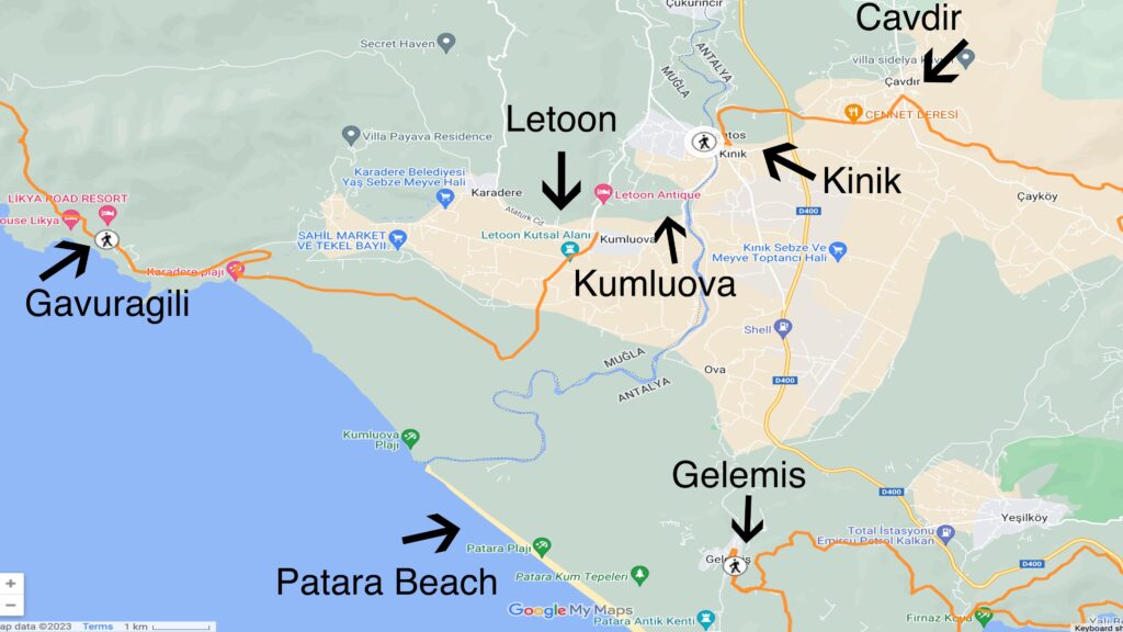
- You will hike from Patara to Letoon.
- This is a very easy section with a distance of 8km
- Way-finding is very easy in this section with many signposts at key junction points
- You will cross dunes and cobblestone roads
- You can camp on the dunes here
- One note is there have been reports of menacing dogs in this area
- There are ruins at Letoon-most people opt to take a minibus to this area, then to Xanthos, and continue on to Akbel
- You will hike from Letoon to Kumluova
- This is a very easy section with a distance of 2km
- There’s a water fountain and several markets
- This trail follows flat roads through greenhouses
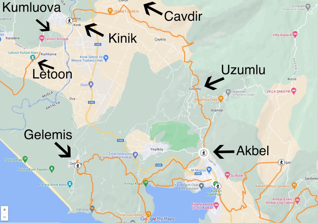
- You will hike from Kumluova to Kinik
- This is a very easy section with a distance of 3.5km
- There are not any accommodation options in Kinik
- You will hike from Kinik-Cavdir
- This is an easy section with a distance of 5km
- You will pass through the Xanthos ruins here
- Camping at the Xanthos ruins is not permitted, but there are descent camping spots to the North
- There’s an entrance fee for access to the Xanthos ruins
- You will hike from Cavdir to Uzumlu
- This is a moderate section with a distance of 9km
- You will hike through the hillsides
- Most of the trail will be directly on the remains of a Roman aqueduct
- There’s a water source at the mosque
- The terrain is too rocky to camp, unless on the NE portion of this section
- You will hike from Uzumlu to Akbel
- This is a moderate section with a distance of 6km
- You will hike on roads, tracks, and narrow hillsides
- Passes through the town of Islamlar
- There are markets and water fountains in Islamlar