Your cart is currently empty!
Hiking From Kas to Bogazcik on the Lycian Way
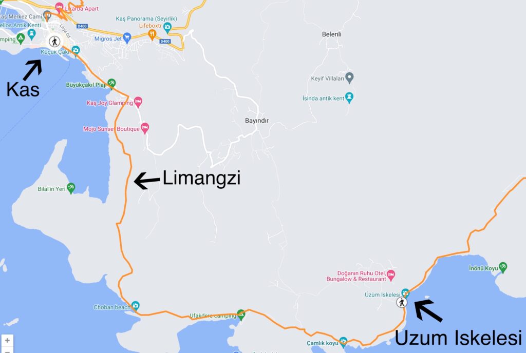
Total Distance: 19km
The first section is hiking from Kas to Limanagzi on a scenic costal path. *This section is great for day hiking from Kas
You will follow mostly rural roads and pass through the beach resort Buyuk Cakli, here you can buy food and water.
Near Limanagzi is an exciting section that uses rope handholds to pass Lycian Tombs cut into the cliff face. During bad weather, it’s recommended to skip this section.
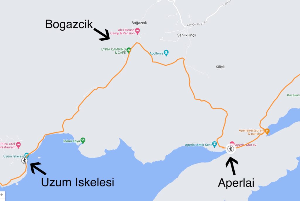
From Limanagzi you will trek a difficult section of steep hills to Bogazcik.
There are great coastal views, but this section can be very difficult and exhausting on the legs. It’s also the longest part of this section,15km.
You will pass nearby Uzum Ikelesi, here there is a water source and some decent camping. The rest of the trail, however, is to rocky to camp.
Cell reception is very bad in this area!